Property Record
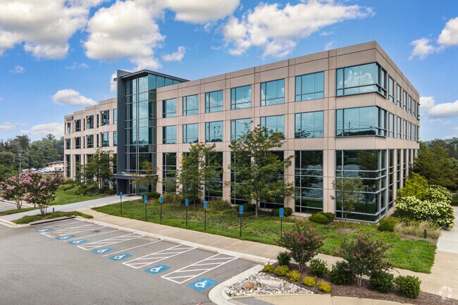
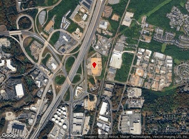
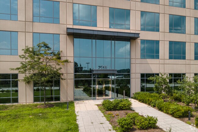
7961 Loisdale Rd, Springfield, VA 22150

NEARBY LISTINGS FOR SALE OR LEASE
Property Detail
7961 Loisdale Rd
Washington-Arlington-Alexandria, DC-VA-MD-WV
Accotink Station
0992-01-0007A
ACCOTINK STATION
Officebuilding
Fairfax
X
Virginia
24017C0025C
7a
2023
17.54 AC
2023
Springfield/Burke
421002
Washington, DC
223,962 SF
DEMOGRAPHICS near 7961 Loisdale Rd
1 Mile
3 Mile
5 Mile
2024 Total Population
4,951
86,729
236,662
2029 Population
4,854
85,253
232,628
Pop Growth 2024-2029
(1.96%)
(1.70%)
(1.70%)
Average Age
39
40
39
2024 Total Households
1,747
31,194
81,398
HH Growth 2024-2029
(2.18%)
(1.80%)
(1.85%)
Median Household Inc
$168,801
$130,174
$131,643
Avg Household Size
2.80
2.70
2.80
2024 Avg HH Vehicles
2.00
2.00
2.00
Median Home Value
$657,221
$604,324
$600,184
Median Year Built
1990
1986
1982
Nearby Places
Map Layers
Map Styles
 Street
 Aerial
- Restaurants
- Banks
- Shops
- Fitness
- Groceries
PUBLIC TRANSPORTATION
COMMUTER RAIL
Lorton (Fredericksburg Line - Virginia Railway Express)
DRIVE
WALK
Distance
Lorton (Fredericksburg Line - Virginia Railway Express)
8 min
4.0 mi
Franconia-Springfield (Fredericksburg Line - Virginia Railway Express)
DRIVE
WALK
Distance
Franconia-Springfield (Fredericksburg Line - Virginia Railway Express)
11 min
4.8 mi
AIRPORT
Ronald Reagan Washington Ntl
DRIVE
WALK
Distance
Ronald Reagan Washington Ntl
22 min
13.7 mi
Washington Dulles International
DRIVE
WALK
Distance
Washington Dulles International
47 min
30.3 mi
Freight Ports
Port of Baltimore
DRIVE
WALK
Distance
Port of Baltimore
80 min
54.9 mi
SALE & LEASE HISTORY
LISTING DATE
SALE/LEASE

Sep 25, 2016
For Lease
Dec 14, 2018
For Lease
Nearby Properties
Address
Land Use
TOTAL SIZE
Lot Size
Zoning
Address
Land Use
TOTAL SIZE
Lot Size
Zoning
717,618 SF
16.81 AC
340
Address
Land Use
TOTAL SIZE
Lot Size
Zoning
824,193 SF
16.06 AC
400
Address
Land Use
TOTAL SIZE
Lot Size
Zoning
631,189 SF
9.48 AC
497
Address
Land Use
TOTAL SIZE
Lot Size
Zoning
2,239,442 SF
58.08 AC
130
Address
Land Use
TOTAL SIZE
Lot Size
Zoning
480,165 SF
21.23 AC
304
Address
Land Use
TOTAL SIZE
Lot Size
Zoning
73,835 SF
27.26 AC
540
Address
Land Use
TOTAL SIZE
Lot Size
Zoning
1,286,047 SF
69.60 AC
540
Address
Land Use
TOTAL SIZE
Lot Size
Zoning
338,106 SF
26.50 AC
304
Address
Land Use
TOTAL SIZE
Lot Size
Zoning
361,251 SF
10.96 AC
312
Address
Land Use
TOTAL SIZE
Lot Size
Zoning
394,657 SF
10.47 AC
340
Address
Land Use
TOTAL SIZE
Lot Size
Zoning
265,905 SF
5.81 AC
220
Address
Land Use
TOTAL SIZE
Lot Size
Zoning
357,064 SF
19.14 AC
540
Address
Land Use
TOTAL SIZE
Lot Size
Zoning
143.53 AC
198
Address
Land Use
TOTAL SIZE
Lot Size
Zoning
328,350 SF
6 AC
350
Address
Land Use
TOTAL SIZE
Lot Size
Zoning
1,000 SF
23.41 AC
550
Address
Land Use
TOTAL SIZE
Lot Size
Zoning
241,052 SF
13.37 AC
220
Address
Land Use
TOTAL SIZE
Lot Size
Zoning
327,600 SF
12.31 AC
304
Address
Land Use
TOTAL SIZE
Lot Size
Zoning
726,779 SF
57.50 AC
130
Address
Land Use
TOTAL SIZE
Lot Size
Zoning
375,054 SF
17.34 AC
220
Address
Land Use
TOTAL SIZE
Lot Size
Zoning
633,133 SF
39.97 AC
150
Address
Land Use
TOTAL SIZE
Lot Size
Zoning
354,274 SF
22.69 AC
220
Address
Land Use
TOTAL SIZE
Lot Size
Zoning
374,125 SF
2.84 AC
400
Address
Land Use
TOTAL SIZE
Lot Size
Zoning
114,205 SF
14.06 AC
497
Address
Land Use
TOTAL SIZE
Lot Size
Zoning
164,037 SF
21.72 AC
550
Address
Land Use
TOTAL SIZE
Lot Size
Zoning
171,711 SF
16.08 AC
480
Address
Land Use
TOTAL SIZE
Lot Size
Zoning
270,191 SF
1.83 AC
440
Address
Land Use
TOTAL SIZE
Lot Size
Zoning
188,000 SF
4.54 AC
400
Address
Land Use
TOTAL SIZE
Lot Size
Zoning
106,170 SF
8.39 AC
460
Address
Land Use
TOTAL SIZE
Lot Size
Zoning
94,712 SF
8.44 AC
304
The World's #1 Commercial Real Estate Marketplace
Connect with us
© 2026 CoStar Group
The information above has been obtained from sources believed reliable. While we do not doubt its accuracy we have not verified it and make no guarantee, warranty or representation about it. It is your responsibility to independently confirm its accuracy and completeness. Any projections, opinions, assumptions, or estimates used are for example only and do not represent the current or future performance of the property. The value of this transaction to you depends on tax and other factors which should be evaluated by your tax, financial, and legal advisors. You and your advisors should conduct a careful, independent investigation of the property to determine to your satisfaction the suitability of the property for your needs.